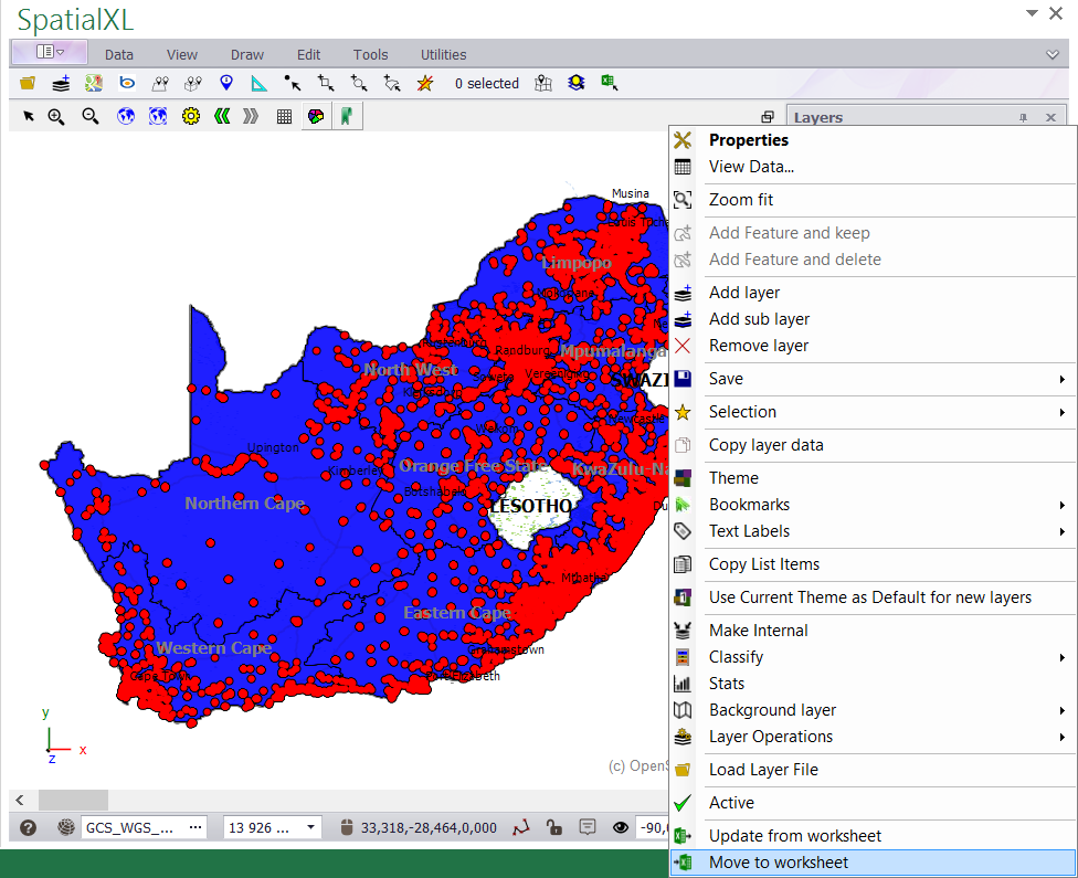
1. Right click the layer in your LAYERS DESCRIPTION box and click MOVE TO WORKSHEET.
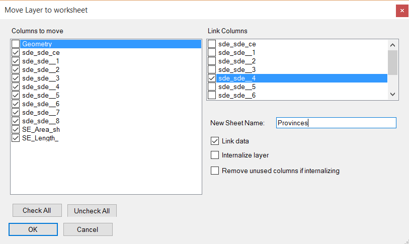
2. In the MOVE LAYER TO WORKSHEET box that appears set the following:
• Tick on CHECK ALL.
• Tick off GEOMETRY.
• For the LINK COLUMNS choose the unique ID that has data for each record e.g. SP_CODE .
• Change the name of the worksheet if required.
• Tick on LINK DATA. (This will ensure your spreadsheet data is linked to your map layer.)
• Click OK when you are finished.
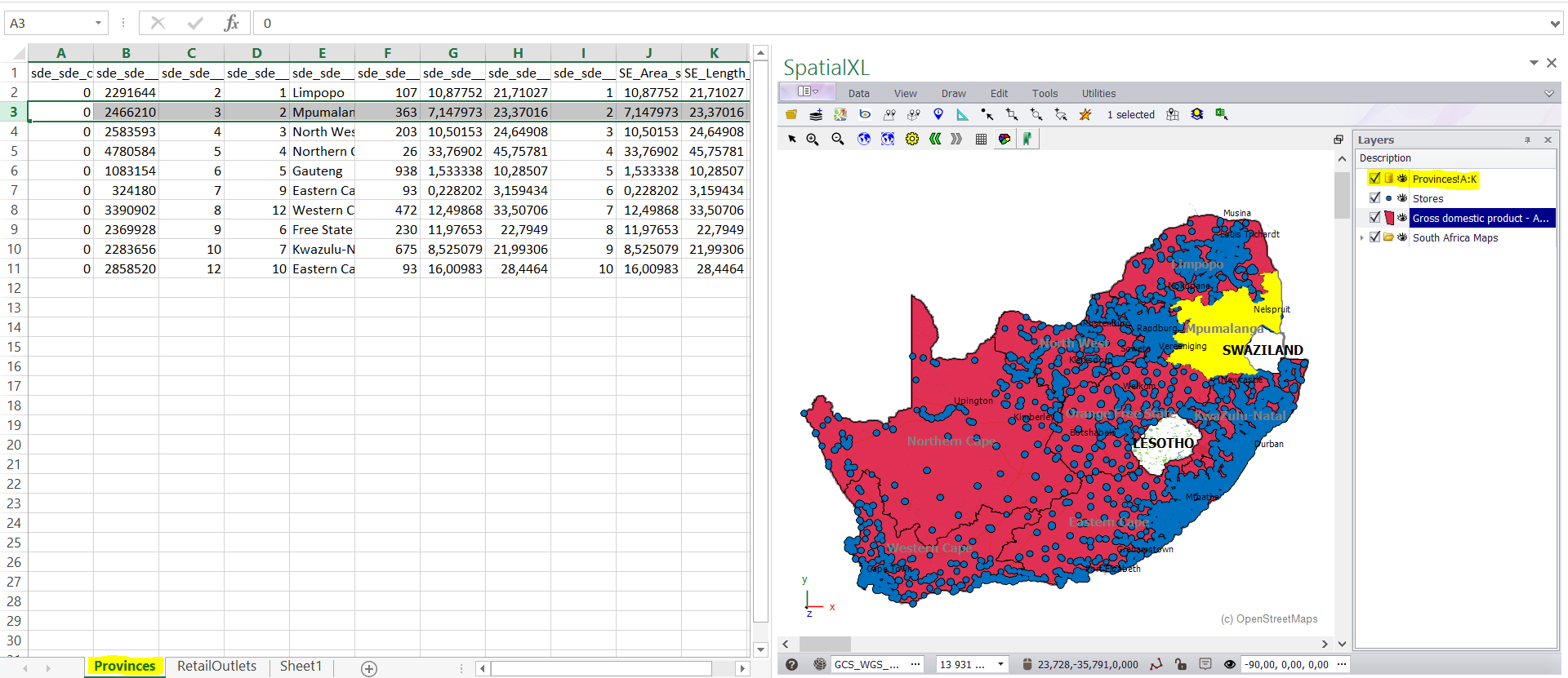
3. The attribute (grid) data will now appear as a spreadsheet in your workbook and is linked to your shapefile.
4. Any filters you do in your spreadsheet will automatically display on your map.
5. A non-graphic linked layer will also add to your LAYERS DESCRIPTION box. This holds the link information between your
shapefile and your spreadsheet. If you remove this layer you will break the link.
|
Copyright (c) PrimeThought Software Solutions CC


